
File:Bản đồ Hà Nội.png
Num kura awobe: 600 × 599 pixels. Gade resolutions: 240 × 240 pixels | 481 × 480 pixels | 769 × 768 pixels | 1,025 × 1,024 pixels | 2,051 × 2,048 pixels | 3,000 × 2,996 pixels.
File usuli be (3,000 × 2,996 pixels, file size: 3.46 MB, MIME type: image/png)
| Bayin |
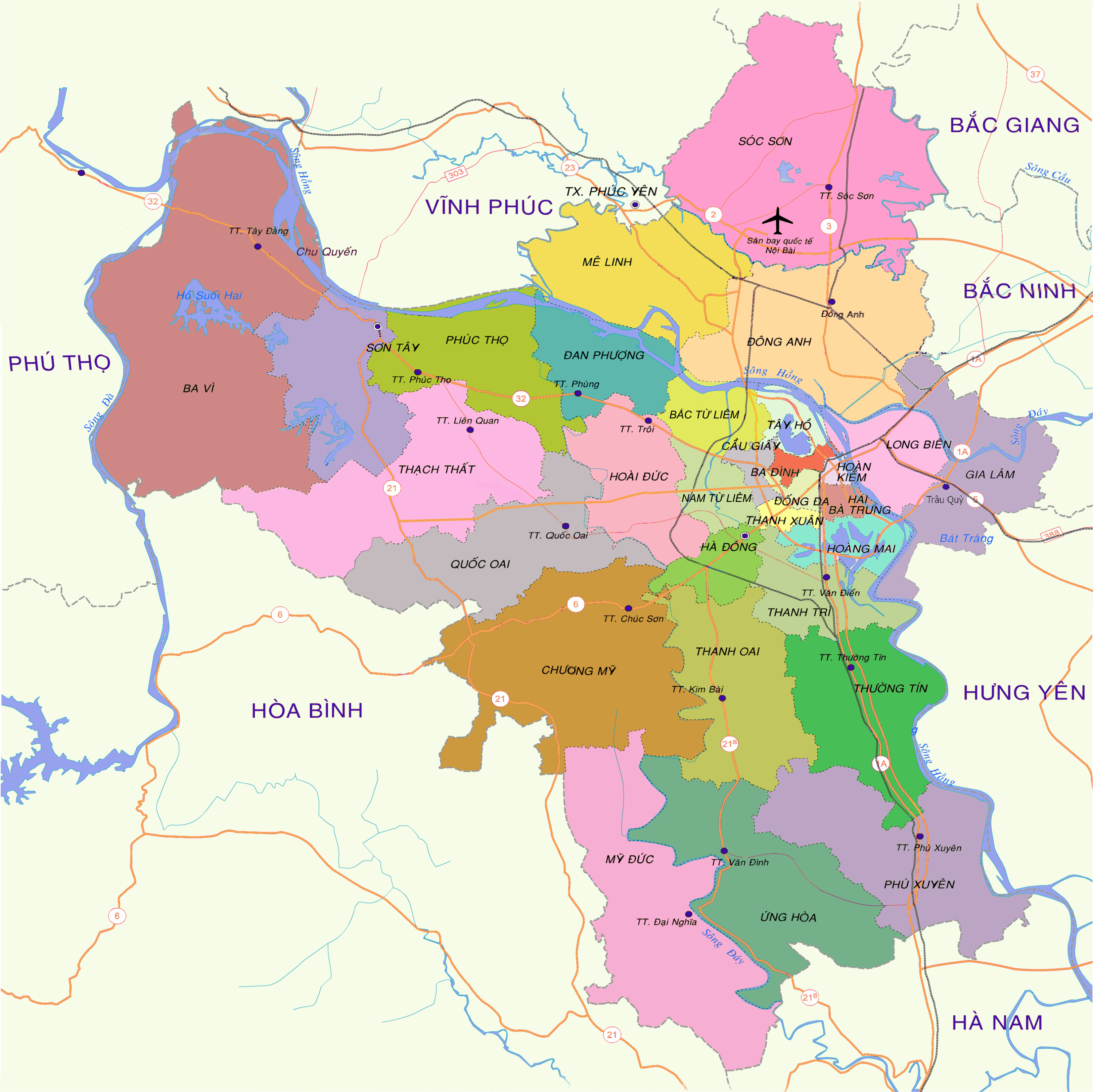
English: Map of Hanoi at the end of 2008
Tiếng Việt: Bản đồ Hà Nội cuối năm 2008 |
| Kaü kentaü be | 15:19, ngày 30 tháng 12 năm 2008 (UTC) |
| Usulu | vi:Tập tin:Bản đồ Hà Nội.png |
| Ruoma | Lưu Ly |
| Izini (File waltim faida) |
This file is licensed under the Creative Commons Attribution 3.0 Unported license.
|
| Other versions | vi:Tập tin:Bản đồ Hà Nội (tạm).png |

.png)
| Annotations | This image is annotated: View the annotations at Commons |
| Camera location | | View this and other nearby images on: OpenStreetMap |
|---|
Gargam file be
Kentawu wa luktu wa ranne file de rui
| Kentawu/luktu | Thumbnail | Nakkaa nguwu | Faidatema | Mana | |
|---|---|---|---|---|---|
| kərma | 16:52, 27 Jimada gaji 2013 | | 3,000 × 2,996 (3.46 MB) | Tran The Vinh | chia đơn vị hành chính |
| 09:31, 27 Armalan 2009 |  | 2,976 × 2,972 (2.31 MB) | Newone | {{Information |Description={{en|1=Map of Hanoi at the end of 2008}} {{vi|1=Bản đồ Hà Nội cuối năm 2008}} |Source=vi:Tập tin:Bản đồ Hà Nội.png |Author=Lưu Ly |Date=15:19, ngày 30 tháng 12 năm 2008 |
Faida file be
There are no pages that use this file.