
File:Terzijski Most.JPG

File usuli be (2,048 × 1,536 pixels, file size: 932 KB, MIME type: image/jpeg)
Kasartǝ
| Bayin |
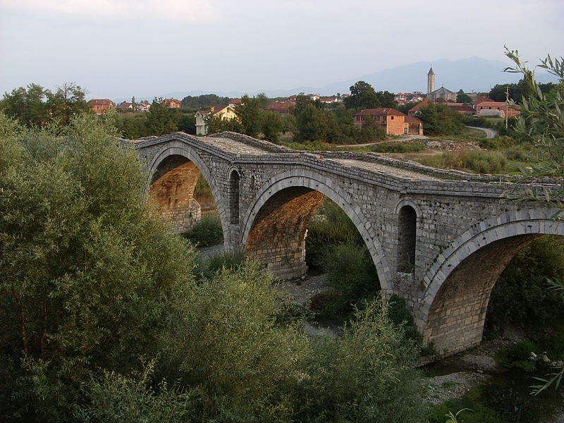
Deutsch: Die Terzijski-Brücke über den Erenik bei Gjakova, Kosovo.
English: Terzijski Bridge on Erenik River near Gjakova, Kosovo.
Shqip: Ura e Terzive në lumin Erenik afer Gjakovës, Kosovë. |
||
| Kaü kentaü be | |||
| Usulu | Self-photographed | ||
| Ruoma | Julian Nyča | ||
| Izini (File waltim faida) |
 Die kostenlose Weiternutzung dieses Bildes, insbesondere kommerzieller Natur, ist im Sinne der unten genannten Lizenz nur unter folgender Bedingung gestattet:
Durch die Bildnutzung erklären Sie sich mit den Lizenzbedingungen einverstanden. Im Falle eines Verstoßes gegen die Lizenzbedingungen erlöschen die Nutzungsrechte automatisch. Ich behalte mir vor, in diesem Fall ein nachträgliches Nutzungsentgelt in Rechnung zu stellen. Werden größere Versionen des Bildes oder eine Nutzung ohne Namensnennung gewünscht, bitte vorher hier anfragen!
 Bjezpłatne dalewužiwanje tutoho wobraza, wosebje komercielneho razu, je w zmysle podateje licency jenož pod slědowacym wuměnjenjom dowolene:
Z wužiwanjom wobraza akceptujeće licencowe wuměnjenja. W padźe zranjenja licencowych wuměnjenjow wužiwanske prawo awtomatisce zhubiće.
Weitere Bilder von Julian Nyča: alle – nur aus dem Album Kosovo – nur von 2008 Kontakt für Anfragen: julian.nyca (at) luzica.la
|
| Camera location | | View this and other nearby images on: OpenStreetMap |
|---|
Lasisi yo

|
Nyiro izini sadena gone, samne kuru/aw Document adǝ falle cidiya sharadu awo Izni GNU bǝ deye, Luwo 1.2 aw luwo gadǝ huwu bǝ sulin ma karafka sofware deye yo ye; sashi faltǝ ba, ruwo fuwu yǝ bawo, kuru ruwo ngawo yǝ bawo . Jiri izni bǝ dǝ suro sashi bǝ dǝn bǝji GNU izni Documentation bǝ. |
- Ran nimin:
- yakte wa – gota, yaktuwa kuru yado wa
- kalakte – chida gota wa
- Cideya conditions hu be
- genata – Asker nǝ nglaro,link izni bǝ yǝ, kuru flǝnǝ chandi tidina,bayin nglama yǝ, kuru jiriyi yaye giyi futu donyi izni njoma nyiro chinama
Gargam file be
Kentawu wa luktu wa ranne file de rui
| Kentawu/luktu | Thumbnail | Nakkaa nguwu | Faidatema | Mana | |
|---|---|---|---|---|---|
| kərma | 12:45, 4 Maraam 2009 | | 2,048 × 1,536 (932 KB) | J budissin | == Beschreibung == {{Information |Description= {{de|Die alte Straßenbrücke über den Erenik bei Gjakova/Đakovica, Kosovo.}} {{en|Old road bridge on Erenik River near Gjakova/Đakovica, Kosovo.}} |Source=own photograp |
Faida file be
There are no pages that use this file.